Devpost
Participate in our public hackathons
Devpost for Teams
Access your company's private hackathons
Grow your developer ecosystem and promote your platform
Drive innovation, collaboration, and retention within your organization
By use case
Blog
Insights into hackathon planning and participation
Customer stories
Inspiration from peers and other industry leaders
Planning guides
Best practices for planning online and in-person hackathons
Webinars & events
Upcoming events and on-demand recordings
Help desk
Common questions and support documentation
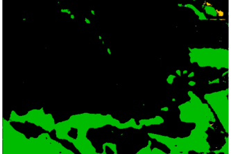
Prithvi4QR is a fine-tuned foundation model for decision support in large-scale disaster response. It segments roads, buildings, and water from aerial images, aiding resource allocation.
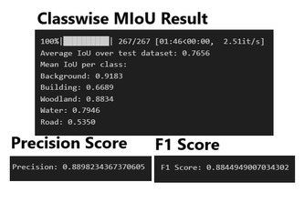
Foundation model for Earth Observations. Semantic Segmentation for maps in the Landcover.ai dataset.
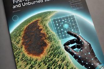
BurnScape: Empowering Wildfire and Land Management with AI-driven Burned Area Detection.
"It's a heavy lift and processing, but we have got this!" ~Atlas, the Greek God of strength and endurance.
Tagline:High-Precision Landcover Mapping Using UNet++: Optimizing Accuracy in Multi-Class Segmentation of Aerial Imagery
We built a high-resolution land cover mapping model with a Swin Transformer that classifies roads, buildings, and vegetation for urban planning and disaster response.
1 – 6 of 6